From quick and easy loops around town to drives that take you to fantastic lakes and mountains, our city has so many options to hit the trail. So lace up your hiking boots, because we’ve compiled a hiking guide for the Greenville area with 20+ routes and trails to help you plan your next adventure and experience breathtaking views.
Note: While parks and trails may be listed as open, we recommend checking park websites before visiting for further info, current trail conditions, and safest practices for the area, especially after Hurricane Helene.
Key: Easy = 🥾| Moderate = 🥾🥾 | Hard = 🥾🥾🥾
Greenville
Lake Placid Loop, Paris Mountain State Park, 2401 State Park Rd.
- Difficulty: 🥾
- Length: .75 mile loop
- Pet-friendly: Yes
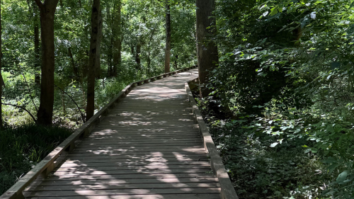
Hike this trail if you want lake views and (mostly) flat ground. You may see wildlife like birds or turtles as you circle the lake, cross a boardwalk foot bridge, and pass the swimming area.
Sulphur Springs Trail, Paris Mountain State Park, 2401 State Park Rd.
- Difficulty: 🥾🥾🥾
- Length: 3.8 mile loop
- Pet-friendly: Yes
Hike this trail if you want to see an old water tower and dam (and hike a pretty steep hill for about .25 miles). Pro tip: It’s easy to get lost on this trail since it has an upper and lower section so download a map of the park to your phone before you go.
Brissy Ridge Trail, Paris Mountain State Park, 2401 State Park Rd.
- Difficulty: 🥾🥾
- Length: 2.9 mile loop
- Pet-friendly: Yes
Hike this trail if you want to explore a steep route along some of the Upstate’s hills. There is a hiker’s only portion (which is much steeper than the rest of the trail) and there are lots of tree roots on the ground so watch your footing. Be on the lookout for mountain bikers on the other sections of the trail. (Remember, hikers yield to bikers on the downhill.)
Beyond Greenville
The Natural Trail, Cedar Falls State Park, 201 Cedar Falls Rd., Fountain Inn, SC
- Difficulty: 🥾
- Length: 1.5 miles
- Pet-friendly: Yes
Hike this trail if you’re looking for a family friendly trip with views of the Reedy River. This route extends from the tree line above the playground to the Reedy River near the shoals and features three connector trails. Within the park, the Reedy River widens to over 200 ft. in a cascade over rocks and boulders.

This table rocks. | Photo by @upstateoutdooradventurer
Lakeside Trail, Table Rock State Park, 158 Ellison Ln., Pickens
- Difficulty: 🥾
- Length: 1.9 mile loop
- Pet-friendly: Yes
Hike this trail if you want a leisurely walk with some historic elements (and great views of Table Rock). It’s considered to be a good alternative route for families looking to avoid steeper mountain trails. Added perk, you don’t need to worry about completing a hiking registration card for this route.
Pinnacle Mountain Trail, Table Rock State Park, 158 Ellison Ln., Pickens
- Difficulty: 🥾🥾🥾
- Length: 8.4 miles out-and-back
- Pet-friendly: Yes (dogs are allowed but it may be difficult for them to climb up some of the large rocks)
Hike this trail if you want a serious challenge with uninterrupted mountain views from the tallest mountain in S.C. On this route you’ll encounter creek crossings with small footbridges + steep mountain slopes. On your way back, you can return the way you came or (for a less strenuous option) you can follow the Ridge Trail to the Table Rock Trail.
Carrick Creek Trail, Table Rock State Park, 158 Ellison Ln., Pickens
- Difficulty: 🥾🥾
- Length: 2 mile loop
- Pet-friendly: Yes
Hike this trail if you want to see lots of waterfalls and can handle some steep elevation changes. Be sure to check out the observation deck less than 100 yards up the trail at Carrick Creek Falls. There are three other trails in the park, including Table Rock Trail which summits Table Rock Mountain. See those here.
Natural Bridge Nature Trail, Keowee-Toxaway State Park, 108 Residence Dr., Sunset
- Difficulty: 🥾🥾
- Length: 1.3 miles
- Pet-friendly: Yes
Hike this trail if you want views of Lake Keowee, mountain laurel, and natural blueberry bushes. Natural Bridge Nature Trail is aptly named for the natural bridge that allows you to cross Poe Creek.
Raven Rock, Keowee-Toxaway State Park, 108 Residence Dr., Sunset
- Difficulty: 🥾🥾
- Length: 4.4 mile loop
- Pet-friendly: Yes
Hike this trail if you want a longer outing on land that Cherokee Indians once traversed. This trail starts at the Meeting House and is well-marked. Wildlife in this park includes white tail deer, chipmunks, and salamanders.

We’re jonesing for this. | Photo by @upstateoutdooradventurer
Rainbow Falls Trail, Jones Gap State Park, 303 Jones Gap Rd., Marietta
- Difficulty: 🥾🥾
- Length: 4.4 miles out-and-back
- Pet-friendly: Yes
Hike this trail if you’re looking for waterfall views or bird watching. Other great waterfalls to see in Jones Gap State Park include: Falls Creek Falls, Jones Gap Falls, and Silver Steps Falls. Jones Gap State Park has limited parking, so get there early. There is also little-to-no cell phone coverage.
Hospital Rock Trail, Jones Gap State Park, 303 Jones Gap Rd., Marietta
- Difficulty: 🥾🥾🥾
- Length: 8.8 miles out-and-back
- Pet-friendly: Yes
Hike this trail if you’re looking for a serious challenge – it’s identified as one of the “most rugged and difficult trails in the state.” Legend says Confederate deserters hid out under Hospital Rock during the Civil War.
Oconee Bell Nature Trail, Devils Fork State Park, 161 Holcombe Cir., Salem
- Difficulty: 🥾🥾
- Length: 1.5 loop
- Wheelchair accessible: No
- Pet-friendly: Yes
Hike this trail if you want to spend the day relaxing by a pond. This hike starts in the parking lot near the Ranger Station and is well-marked (making it a great option for first time hikers). The path leads you through a hardwood forest and along a creek. DYK Devils Fork State Park gets its name from a rare wild flower?
Hidden Falls, Oconee State Park, 624 State Park Rd., Mountain Rest
- Difficulty: 🥾🥾
- Length: 2.4 miles
- Pet-friendly: Yes
Hike this trail if it’s rained recently. The Hidden Falls will be in its prime after a storm – the flow drops 60 ft. over a series of granite ledges but during dry conditions it may be reduced to a trickle. Rock benches offer hikers a place to sit and take in the dense underbrush.
Old Waterwheel Trail, Oconee State Park, 624 State Park Rd., Mountain Rest
- Difficulty: 🥾🥾
- Length: 1.2 miles
- Pet-friendly: Yes
Hike this trail if you’re in the mood for a quiet, scenic and wooded route. The trail will lead you to the remnants of the stone structure where a waterwheel was used (it’s since been moved to the park lake). This route can be a bit harder to follow, so keep an eye on the trail markers. You can extend your hike by taking the Oconee Trail.
Tamassee Knob, Oconee State Park, 624 State Park Rd., Mountain Rest
Difficulty: 🥾🥾🥾
- Length: 2 miles
- Wheelchair accessible: No
- Pet-friendly: Yes
Hike this trail if you’re willing to work a bit for a killer view. Though challenging, the path is well-maintained and well-shaded. Wear good shoes with strong ankle support because at times the trail does fall off sharply on both sides. The end of the route rewards hikers with views of the Carolina Blue Ridge Mountains and a boulder where you can set up a picnic.
Exclamation Point, Oconee State Park, 624 State Park Rd., Mountain Rest
- Difficulty: 🥾🥾
- Length: 2.9 miles
- Pet-friendly: Yes
Hike this trail if you want to access the highest peak in the park (2,480 ft.). Along the Exclamation Point trail, you’ll pass the Opera Box and Devils Head (a rock shaped like the Devil). Once you’ve reached the top, you’ll witness the beauty of Hickory Nut Gorge and look down over Chimney Rock and Lake Lure. For added adventure, take the Skyline Trail from the Exclamation Point. Pro-Tip: Bring tons of water and a snack. There are several great resting stops to enjoy a picnic.
The other Carolina
Appalachian District: Max Patch Mountain Trail, Pisgah National Forest, 1600 Pisgah Hwy., Pisgah Forest, NC
- Difficulty: 🥾🥾
- Length: 1.5 miles
- Pet-friendly: Yes
Appalachian District: Linville Falls, Pisgah National Forest, 1600 Pisgah Hwy., Pisgah Forest, NC
- Difficulty: 🥾🥾
- Length: 2.2 miles
- Wheelchair accessible: No
- Pet-friendly: Yes
Hike this trail if you want epic views of Linville Gorge’s enormous waterfalls. This route gives hikers access to three waterfall overlooks and at the end, you’ll find southbound views of the gorge itself. We recommend trying this hike during the summertime – if you head there in the morning, you may catch fog lifting from the valley + the sun rising on the opposite ridge.
Pisgah District: Black Balsam Knob via Art Loeb Trail, Pisgah National Forest, 1600 Pisgah Hwy., Pisgah Forest, NC
- Difficulty: 🥾
- Length: 1.4 miles
- Wheelchair accessible: No
- Pet-friendly: Yes
Hike this trail if you want to experience Black Balsam Knob, the 23rd highest of the 40 mountains in North Carolina over 6,000 ft. (an elevation of 6,214 ft.). This hike is incredibly unique since you are hiking among the balds rather than a steep incline. Pro-Tip: The best time for this hike + camp is late April-October. This part of the Parkway is closed during winter.
Pisgah District: John Rock, Pisgah National Forest, 1600 Pisgah Hwy., Pisgah Forest, NC
- Difficulty: 🥾🥾
- Length: 5.7 miles
- Wheelchair accessible: No
- Pet-friendly: Yes
Hike this trail if you’re looking for a “ranger favorite.” The trail is forested with waterfalls + great views year-round. Hiking with youngins? There’s a small paved trail behind the Pisgah Center for Wildlife Education. You can also plan a visit to the Fish Hatchery.
Big Glassy Mountain Trail, 81 Carl Sandburg Ln., Flat Rock, NC
- Difficulty: 🥾
- Length: 2.6 miles out-and-back
- Wheelchair accessible: No
- Pet-friendly: Yes
Hike this trail if you’re looking to explore Big Glassy Mountain or the grounds of Carl Sandburg’s historic home. This hike starts just behind the house and features a small reservoir, rock outcroppings, and benches. There’s no fee to visit the National Historic Site, but you will need to pay to tour the home itself.
Bearwallow Mountain Trail, 4854 Bearwallow Mountain Rd., Hendersonville, NC
- Difficulty: 🥾🥾
- Length: 1.7 miles
- Wheelchair accessible: No
- Pet-friendly: Yes
Hike this trail if you’re looking for a great year-round hike. With panoramic views, you can have a picnic and watch the sunset. (Just note that there are cows grazing this privately owned area that is protected by a land conservation easement – yes it is still OK to hike). The hike up the trail is kind of strenuous, but one can take the service-road for an easier route.
Stone Mountain, DuPont State Forest, 1300 Staton Rd., Cedar Mountain, NC
- Difficulty: 🥾🥾🥾
- Length: 2.65 miles
- Wheelchair accessible: No
- Pet-friendly: Yes
Hike this trail if you’re interested in the views from 3,620 ft. (the tallest summit in the park). A shorter route is available off Sky Valley Rd., but note – this path does not avoid the steepest sections of the hike. Fun fact: Scenes from The Hunger Games and The Last of the Mohicans were filmed in this state forest.
Bridal Veil Falls, DuPont State Forest, 1300 Staton Rd., Cedar Mountain, NC
- Difficulty: 🥾🥾
- Length: 4.6 miles
- Pet-friendly: Yes
Hike this trail if you’re a photographer looking to snag some long-exposure waterfall shots. Bridal Veil Falls drops in two series – the first being a freefall and the second being “veil-like sheet” falls across a rock outcrop. An overhanging ledge allows you to walk along the backside of the waterfall.
Four Seasons Trail, Chimney Rock State Park, 431 Main St., Chimney Rock, NC
- Difficulty: 🥾🥾
- Length: 0.6 miles
- Wheelchair accessible: No
- Pet-friendly: Yes
Hike this trail if you’re looking for year-round mountain access without driving. You may see deer or wild turkey on this 400 ft. climb. The Four Seasons trail connects with the Hickory Nut Falls trail.
Lookout Trail, Montreat, NC
- Difficulty: 🥾🥾
- Length: 1.4 miles
- Wheelchair accessible: No
- Pet-friendly: Yes
Hike this trail if you’re on the hunt for beautiful views and a great place to watch the sunset or sunrise. If you look at the horizon, you’ll see the peaks of the Seven Sisters of the Black Mountains. This is a popular trail, visited throughout the year by families and large groups. Safety note: This trail does have some very steep patches and requires climbing over rocks towards the top.
Get the right gear
Get the most out of your trip with comfortable, handy, and helpful hiking gear:
- For the best footwear, check out Nordstrom Rack’s sneaker edit for hiking.
- If your trail demands a proper hiking boot, we like Columbia’s collection on Amazon.
- For apparel that’s both flattering and functional, we turn to small business Aesthetic Built. We love the oversized scuba hoodies for women and the muscle scallop tees for men.
- Travel light (but still have room for snacks) with lululemon’s Everywhere Belt Bag.
- Get a good bulk deal on Perfect Bars, Clif Bars, or Kind Bars at a warehouse store like Sam’s Club.
- Don’t forget to bring a compact, portable phone charger (you’ll thank us later).
- We like this Teton hiking backpack.
- We like this lightweight water bottle.
- Psst — to be ultra-prepared, here are the 10 items you should never enter a national park without, according to the National Park Service.


